New Jersey Licensed Land Surveying Services, Elevation Certificates, ALTA/ACSM Land Title Surveys, Construction and Civil Engineering Services - over 34 years of local experience
We serve New Jersey: Northern North NJ, Sussex County, Morris County, Bergen County, Hunterdon County, Warren County, Passaic County, Hunterdon County, Monmouth County, Somerset, County, Northern NJ, North NJ, Central NJ, New Jersey
Some of our Land Surveying Services Include :
How much for, the cost of, E-loma, flood insurance Elevations Certificates, Land Surveying, Construction Stakeout, Stakeout for Property Lines, survey Mapping, Final Maps, Major and Minor Subdivisions, Deed Descriptions, Topographic Surveys, Topography, Boundary Surveys, ALTA land surveys, and much much more.
About Careaga Engineering
Careaga Civil Engineering and Land Surveying has been helping thousands of satisfied customers completing Boundary Maps, Topographic Maps, Elevation Certificates, Deed Descriptions, along with other services including septic System Design, Grading Plans, Construction Stakeout, Wetland LOI mapping, Flood Hazard Area elevation verification and NOV as-built, Land Surveyor Work, Boundary Survey, Structural Repair and Inspections, Commercial Site Plans, Site Plans, Lot Feasibility Studies, Septic Inspections,Eco Aire Installations, Norweco treatment installations, Septic Tank Repair, Septic Design Services and more. Our Northern New Jersey location allows us to conveniently serve Sussex County, Morris County, Bergen County, Warren County, Passaic County, Essex County and Hudson County.
We serve the following locations in New Jersey:
Stanhope Newton NJ, Franklin NJ, Mount Olive NJ, Lake Hopatcong NJ, Budd Lake NJ, Randolph NJ, Flanders NJ, Roxbury NJ, Denville NJ, Chester NJ, Sparta NJ, New Brunswick NJ, Franklin Lakes NJ, Montclair NJ, Livingston NJ, Byram NJ, Jefferson NJ, Dover NJ, Morristown NJ, Montville NJ, Morris Plains NJ, Rockaway NJ, Mendham NJ, Washington NJ and Hackettstown NJ among others.
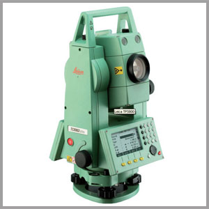
Careaga Engineering has an in-house survey department with a Licensed Land Surveyor supervising the completion of Topographic (Topo) Survey work, Title Survey Work, Boundary Surveys, Minor and Major Subdivisions, ALTA/ACSM Land Title Surveys, Lines and Grades, meets and bounds deed descriptions, construction stakeout work for fences, structures, curbing, roadways, drainage systems, house additions, and more.
Critical survey scheduling requirements are easily met for all our clients, typical response time less than one week. Typical cost of boundary / title survey is $850.00 up to one acre plus $125 per corner / capped pin set.
Careaga has the capability of mobilizing separate survey crews, as a result, our clients do not have to wait. Careaga Engineering provides a wide range of surveyor services for both existing and proposed single family lots as well as large multi-lot subdivisions and commercial sites. We are also very familiar with preparation of flood insurance Elevation Certificates and LOMA applications, NJDEP permitting survey requirements, and NOV restoration plans.
Some of the specific survey services are listed below:
Title Surveys, ALTA/ACSM Land Title Surveys per American Land Title Association and the American Congress on Surveying and Mapping requirements, Boundary Surveys, meets and bound descriptions ( deed descriptions ), boundary conflicts for attorneys and property owners
Topographical( Topo ) Surveys for lot development plans, septic designs, grading and retaining wall design
Major and Minor Subdivisions - easement and deed descriptions
Elevation Certificates, House Raising and LOMA and e-loma applications
Construction Stakeout, construction layout for land developers and excavators, fence contractors
Vacant Lot Boundary Surveys, setting lot corners (rebar, capped pins, concrete monuments,)
Foundation Stakeout, Foundation Location Surveys, As-Built and Final Surveys for C.O., elevation verification
Metes and Bounds Descriptions, ALTA/ACSM Land Title Surveys, Right-of-Way and Easement Surveys, F.E.M.A. Elevation Certificates, Preparation of Subdivision Plats, Land Use Board Applications, Mapping of Wetlands or Other Environmental Constraints
Direct all email correspondence to jeff@careagaengineering.com or call us at 973-448-0651
Subsurface Utility Mapping, Construction Lay-out, Foundation Location and Final As-Built Surveys, Building height verification, Volume Verification Surveys (Excavation Quantities)
Serving
NJ, North NJ, Northern NJ, Sussex County NJ, Morris County NJ, Passaic County NJ, Union County, Somerset County NJ, Warren County NJ, Bergen County NJ, Hunterdon County NJ, Essex County NJ, Kinnelon NJ, Oakland NJ, Wyckoff NJ, Wantage NJ, Franklin Lakes NJ, Bernards Twp NJ, Jefferson NJ, West Milford NJ, Lake Hopatcong NJ, Randolph NJ, Cedar Knolls NJ, Chatham NJ, Convent Station NJ, Chester NJ, Flanders NJ, Mount Olive NJ, Upper Saddle River NJ, Northen-NJ, Budd Lake NJ, Byram NJ, Denville NJ, Green Pond NJ, Rockaway